NatureScene
Death Valley National Park (1995)
Season 3 Episode 5 | 26m 45sVideo has Closed Captions
Death Valley National Park is located near Death Valley, California.
In this episode of NatureScene, SCETV host Jim Welch along with naturalist Rudy Mancke take us to Death Valley National Park.
Problems with Closed Captions? Closed Captioning Feedback
Problems with Closed Captions? Closed Captioning Feedback
NatureScene is a local public television program presented by SCETV
Support for this program is provided by The ETV Endowment of South Carolina.
NatureScene
Death Valley National Park (1995)
Season 3 Episode 5 | 26m 45sVideo has Closed Captions
In this episode of NatureScene, SCETV host Jim Welch along with naturalist Rudy Mancke take us to Death Valley National Park.
Problems with Closed Captions? Closed Captioning Feedback
How to Watch NatureScene
NatureScene is available to stream on pbs.org and the free PBS App, available on iPhone, Apple TV, Android TV, Android smartphones, Amazon Fire TV, Amazon Fire Tablet, Roku, Samsung Smart TV, and Vizio.
Providing Support for PBS.org
Learn Moreabout PBS online sponsorship(Rudy) Next on "NatureScene," Death Valley National Park, with the lowest elevation in The Western Hemisphere, gives us an opportunity to ex plore Basin and Range geology, as well as adjustments that plants and animals have made to survive there.
A production of... "Nature Scene" is made possible in part by a grant from Santee Cooper, where protection and improvement of our environment are equal in importance to providing electric energy.
Additional funding is provided by the Corporation for Public Broadcasting, and by viewers like you, members of the ETV Endowment of South Carolina.
♪ Hello, and welcome to "Nature Scene" at one of the most unusual places on earth, Death Valley National Park in southeastern California.
I'm Jim Welch with naturalist Rudy Mancke, and we're on Dante's View, more than a mile above this valley floor.
What a special place this thing is.
Geologically, we're going to have a lot of fun with the sttories that we will find here.
Also, we'll take a look at how plants and animals have made adjustmentin a pretty rough, harsh situation.
Certainly it was harsh for people who came here, but the plants and animals have adjusted.
That's an interesting mix.
Even though it's kind of chilly here this morning, starting high will give us the overview, and then we'll slip down and take a close look at some of the variety here, and there's lots to see.
The mountains behind us jump up almost at us, in a sense.
This is basin range geology, and that's one of the ranges.
Those are the Panamint Mountains.
(Jim) That's Telescope Peak, over 11,000 feet, with snow cover until May often.
(Rudy) Snow up on the top.
These are fault block mountains that have come up because of faults in the earth, and blocks of rock were shoved up, and we're standing on one of the ranges.
There is the range beyond us, and in between is what usually is called a valley, but, in fact, it's not a valley proper.
It's called a graben.
It's basically a hunk of rock that has a fault on either side that has depressed down and now is filling with sediments from these ranges on both sides of it.
It's really neat across the way to see those large alluvial fans, they're called.
See them spreading out?
It takes debris from the mountains and then comes and fills this graben.
(Jim) Even though it's filling this valley floor, it's dropping the floor, so it stays.
The lowest point right now is... (Rudy) The floor is going down.
(Jim) Yeah.
(Rudy) The mountains continue up.
These fault zones are very, very active even today.
As we said, those are the Panamint Mountains.
The Cottonwood Mountains are on the west side.
Then the Grapevine and the Funeral and the Black Mountains on our side.
These faults are still continuing to move, relatively young geologically.
This situation has been here for less than 4 million years, which really isn't a tremendously long time.
During Pleistocene times, all that space -- and look at it spread out down there -- was filled with a glacial lake.
Now we just see a salt pan that goes way, way off in the distance.
(Jim) Lake Manly was once over a hundred miles long, six hundred feet deep, and five, six, ten miles wide.
(Rudy) All that's left now of it is a little bit of sign down in the lower part of the valley and then that salt pan.
A little bit of that water, maybe, was left from there.
The west side is now moving away from us, Jim.
The continent is splitting apart here, which is absolutely unbelievable.
Many interesting stories, and some of them are very obvious because the rock has been tilted up.
You remember that Pleistocene lake.
(Jim) And Zabriskie Point, in fact, where all the erosion took place.
(Rudy) Absolutely, with all of that volcanic material that was put into a lake about five million years ago or so, and now that lake bed has been uplifted.
We saw the beautiful colors in that material.
We saw really a badlands look, the best way to describe that, with the dissected earth because of the arid climate now, and rainfall now and then.
(Jim) Very fine sediment there.
(Rudy) Yeah.
Coming a little closer to recent times, the craters.
(Jim) Ubehebe, the Shoshone called it, big basket in the earth.
(Rudy) Steam explosions, it's amazing, again, along fault lines.
Liquid rock comes up sometimes close enough to heat the groundwater and cause steam explosions, and that's what happened there.
The explosions were through an alluvial fan.
You remember the layering was there.
It's covered with a few cinders -- that's all -- and not really a lot of volcanic rock coming out.
That was just thousands of years ago.
(Jim) It was about a half mile across and about five, six hundred feet deep.
(Rudy) Yeah.
This place is like a geological textbook, and what we're going to be able to do on this trip is just turn the pages and see what we can find.
(Jim) Well, we'll be headed into one of the hottest places on earth, so I'm sure we're going to shed these jackets.
(Rudy) That would be a good idea.
Let's get started.
♪ (Jim) Coming out of Titus Canyon.
It was named for a young mining engineer in 1906 who went into the canyon searching for water and disappeared.
(Rudy) It's a steep, narrow canyon, which means it's a young one now.
This hasn't been working for very long.
Look at the rocks on the side, Jim.
It's amazing when you start looking at them, because you begin to see layering.
This is Paleozoic sedimentary rock that is out of position.
When there was uplift along one of the faults, the Funeral Mountains were rising, this stuff slid off -- that's the best way to describe it -- and formed the Grapevine Mountains.
Old limestones -- you can see some lines of calcite in them.
It probably came in as the rock was tumbled and put into this odd position.
(Jim) At times raging floods would come down through, bringing debris of all sizes.
We're standing on thousands of feet of it.
(Rudy) Absolutely, yeah.
That's what fills the basin.
Then there are a few plants now that you would expect right here, right along canyon walls.
(Jim) What is this with the sticky, furry-looking look to the leaf?
(Rudy) Rocknettle is one of the names.
Stingbush is another one.
If you touch it, you're going to have some problems.
I see some leftover fruit on it and this year's leaves.
Clumpy like that, growing in just the right position.
You can predict that plant will be there, and there it is.
(Jim) What's this one over here?
(Rudy) Death Valley goldeneye.
That's one of the composites, clusters of flowers.
They're yellow, so goldeneye is a good name.
Only found in the Death Valley region in all of the United States.
Then down here is a shrub that's going to dominate -- (Jim) Creosote, with golden flowers.
(Rudy) Yeah, yellow flowers, those shiny green leaves, and the smell of creosote, supposedly, after a rain.
That is a dominant shrub in this part of the United States, so typical of the Mojave Desert and adjacent areas.
(Jim) Botanists would call this Mojave Desert, but looking at it, it's also a basin.
Geologists would say this is a basin.
(Rudy) Well, this is what we were talking about a moment ago.
When you've got a canyon like this, you carry all this debris and dump it out to form what's called an alluvial fan.
You can't see the one here very well, but look across the way.
You see it?
(Jim) Huge, yeah.
(Rudy) You see the little canyon, and then it spreads like a fan, and that's debris from that canyon that is spread out, and that is so typical.
That's one of those geological formations that are very, very obvious here.
That tells you there's been uplift over there and then erosion down and then spreading the material all over the place.
And I see -- and we've talked about uplift.
Look at the old fault scar right there.
See it?
(Jim) That's it!
(Rudy) Cutting across the alluvial fan, so the fan was already there.
It's been uplifted since the fan was there.
So that activity continues even today.
Oh, that's neat!
As you said, there are maybe 10,000 feet of sediments filling this basin right now.
I see another plant over here.
Desert-trumpet, look at that!
(Jim) Oh, yeah, which dries in that odd shape.
(Rudy) Yeah.
Inflated stems that are hollow, tiny flowers on it, and that's just now getting started.
The other one that we'll see commonly here, desertholly sometimes it's called.
It's not a true holly.
It's one of the saltbushes, Atriplex , but you see the leaves, and I even see fruit on it.
(Jim) 3.3 million acres here at Death Valley National Park.
Where should we go now?
(Rudy) Let's try for a natural bridge next.
♪ (Jim) Early March is a good time to visit Death Valley because the climate is rather ideal.
It will begin getting very hot as the spring and summer come on.
(Rudy) Yeah.
This is an interesting canyon to compare to Titus Canyon that we just visited, because this is really an alluvial fan, an old one that has now been uplifted and eroded away, and look what you get.
(Jim) It's a conglomerate of sorts, broken pieces, fractured pieces of rock.
(Rudy) This stuff is called fanglomerate.
That's the term for it.
An old alluvial fan that got set in position, then uplifted and then erosion began again.
A natural bridge like this formed because of the flow of water through that fanglomerate.
(Jim) We're talking thousands, hundreds of thousands of years?
(Rudy) Could have been that long.
Yeah, could have been.
Probably thousands would be a pretty reasonable guess.
When you stop here, you can look at the sides and see that material.
Most of it is kind of angular.
It's not really rounded so much, and yet this was a part of an alluvial fan that developed.
Now the rock that stopped here is being carried away and taken somewhere else.
(Jim) This is cemented together with some kind of chemical.
(Rudy) To a degree, and yet with a little pressure, it would probably fall apart.
Natural bridges like this are interesting, but you can imagine the amount of water -- look down here -- that comes through and shaves off the edges of this making the canyon wider, slowly but surely.
We're in a very arid climate.
When the Sierra Nevada Mountains to the west came up, this became a rain shadow, so there is much less water now than there used to be.
Probably this was involved in the days of heavier rains.
(Jim) This is part of the great American desert.
(Rudy) Oh, absolutely.
I'm looking down here, too, right where the canyon ends.
There are a few plants that are so typical of this area.
One of them, Death Valley mojavea is the name.
Lots of yellow flowers on it.
That is one of those species that is an annual.
It comes up, flowers, and dies quickly.
That's one that you would find typically here.
That's a good strategy when you don't have a lot of water.
(Jim) Protection.
All sorts of leaves and stems have to be protected.
(Rudy) There is another one, a little flat one.
See, their leaves are sort of rounded on the base.
Gravelghost is one of the common names for it.
It's a neat name because it's in these gravel beds, and you don't really -- when it's flowering a little later in the year, you don't really see the base of leaves.
You see this flower, and the stem is so small, it looks like a ghost floating in the air.
So gravelghost is the common name for it.
(Jim) What's that other plant there?
(Rudy) The other one with the white flowers on it -- look at it -- is one of the evening primroses.
Camissonia is the genus name.
It's got a little bulb on the end of the stigma there that makes it different from other evening primroses, but typical of this part of the United States.
(Jim) Rudy, this is America's largest national park here in the lower 48.
Where to next?
(Rudy) Next we're going to see that not only does water affect this environment, wind has an effect, too.
♪ (Rudy) What a variety of geological featurs at this national par.
(Jim) Large dunes, probably 15, 20 square miles of dunes here, going on for a long way.
(Rudy) Mainly quartz sands.
There is a little feldspr in it and a little mica.
It's eroded material from quartzites and granite up in the Cottonwood Mountains, slowly but surely working its way down to the vall.
(Jim) And sand of different sizes, I guess, which create the different patterns, to a degree.
(Rudy) Oh, yeah.
This is a good place, Jim.
This shows you the way the dunes work.
Wind blowing from the right, as we view it.
The windward side of the dune is a little flatter.
Then you get up to the top, and the wind keeps going, and then it drops those little sand grains on the back.
See that sharp edge?
The sunlight now gives you a chance to see that.
These are moving dunes.
This is a dune field that's actually on the move, but winds shift seasonally.
So over a long period of time, each dune is moved, but the dune field has remained basically the same.
Then you see a few plants coming in every now and then, maybe to help stabilize them.
(Jim) Rudy, you said that sand comes from the mountains.
I guess it's granite or quartz, mixture of both?
(Rudy) Yeah, and eventually ends up down here.
Then the wind starts working with it, forming these shapes.
Of course, they're changing all of the time.
You can imagine, as we're leaving tracks, every animal that walks across these dunes leaves tracks.
(Jim) One of the few places that people are allowed to come and walk on the dunes.
Some places you need to stay very much on trails.
(Rudy) Yeah, you can get out in them pretty nicely here.
Boy, look at those in the distance there.
That's a really large dune you can see far off in the distance.
Nature is constantly rearranging the world, and you can see it beautifully at a place like this.
We said these plants stabilize things.
I think a good example -- look here.
(Jim) Honey mesquite.
(Rudy) Honey mesquite coming in.
The root system goes pretty deep to get water.
(Jim) Deep being 30, 40, 50 feet?
(Rudy) At least.
Then the body of it traps sand as it's blown and stabilizes it to one degree or another.
As we said, these dunes are moving some but not a lot.
(Jim) Look here, one of the most common birds in the park.
(Rudy) Common ravens.
(Jim) Two of them.
(Rudy) Yeah, two sitting up there.
That's a big bird.
They're adjusted to people here and come into campgrounds and other things to find a free meal.
That's typical of the crow family.
I see something else.
Look at this!
Typical of deserts, look at the lizard.
(Jim) Oh, yeah!
(Rudy) Desert iguana, common name for it.
That's a big animal.
Look at the size of the ear opening on the side there.
Typically marked.
Feeds a lot on plant material, leaves and flowers, but also gets insects and invertebrates.
Oh, that's a neat animal.
(Jim) Good ten inches or so long from tip to tail.
(Rudy) Yeah, and kind of in the shade there.
These plants also offer shade for lots of animals.
If it gets a little too hot, they can run into the shade.
(Jim) Tracks in the sand are always interesting, but these even more so because that is the definitive track of the sidewinder.
(Rudy) Oh, absolutely, and you play detective here a little bit.
The lizard -- those are lizard tracks that sort of zigzag down the side of that ridge of sand.
They were there first.
Then the sidewinder, the snake, came down that hill, crossing those tracks.
You see the "J" shape of the sidewinder, so typical, and impressions of the scales on the belly.
You can see the way he almost lost his balance a little bit, it looks like, coming down the hill, and then all the way down to the bottom.
(Jim) The only rattlesnake we'd see here in the dunes.
(Rudy) Yeah, and perfectly adapted for it.
(Jim) Just one of the hundreds of species of animals that make Death Valley its home.
(Rudy) A special place.
A lot come out more at night than in the daytime.
This is a wonderful place, though, for long views.
This is kind of low here.
We're going to head below sea level next.
♪ (Rudy) Much lower now, and the world begins to change.
(Jim) More plants beginning to take ahold; almost a monoculture, though.
It seems like one species of plant all about us.
(Rudy) This is kind of a salt pan.
We're just now getting down to the salt pan part of Death Valley that we were looking at from above.
Very saline situations and one of the plant species that puts up with salinity well is pickleweed.
Pretty good common name for it, and I'm sure it gets that name from those little thick stems there that you see.
Very succulent plant, gathering up a lot of moisture but also dealing better with salt than most other plants do.
That gives it a chance to dominate here.
The salt's a table salt, and the borates are here, also, and gypsum, other salts like that, are beginning to come out from below.
You can see the white all on the side out there.
Those are salt deposits that are left.
(Jim) We're in what might be called the salt pan, or the Old Lake Manly.
(Rudy) Yeah, absolutely.
Plants that live here are halophytes, the ones that can put up with salty situations nicely.
(Jim) Running right through this area is Salt Creek.
It's about a two-mile long creek that here in the wintertime or early spring you'll see water flowing.
(Rudy) And it is salty.
It's about like seawater.
There is a little fish, though, found nowhere else in the world that lives right in that water.
You can see a group of them there.
The Salt Creek pupfish, common name for it, named after this creek.
Only known from this locality in all the world, so it is an endangered species.
Kind of a mottled-looking fish, fairly small, and feeding on the substrate, on that material on the bottom, detritus, or maybe some algae down there.
Lays eggs, not all in one batch as you might expect, a few here, a few there, because this thing dries up.
(Jim) Exactly.
One might wonder where they came from and how do they exist here in the bottom of Death Valley.
(Rudy) Well, that might be a species that was in that old Pleistocene lake that has now made adjustments to more salinity in the water.
That is a neat little animal, and the only place you can see it in the world is right here.
Also, look at the little caddisflies.
See the insects?
They make a little tube out of debris on the bottom and drag it around.
They are also feeding on that material on the bottom just like the pupfish.
That's a typical insect species you'd find here, and that's the larva.
Salty situations like this with some water.
There is another plant, Jim.
Salt grass is the common name for it, and it makes sense.
It makes adjustments in alkaline situations like this.
(Jim) A little wren over here bobbing up and down.
I couldn't help but notice his little action.
(Rudy) I love the action.
Rock wren is the common name.
It kind of rocks up and down.
It nests in rocks; that's why it's called that.
That's an insect and spider eater looking for a meal on the path.
I see another bird, since we're talking about birds, perched up in that shrub over there.
(Jim) What's that?
(Rudy) Say's phoebe is the common name, and that is one that is typical of this part of the United States and really nowhere else.
Interesting coloration, black on the tail.
Neat bird and an insect eater, too.
One other -- and you start looking here.
Look at him.
(Jim) Oh, yeah.
(Rudy) The lizard in the sun just flattened out there, kind of dark on the back.
A little bit of metallic sparkle on the back, too.
I think that's the side-blotched lizard.
(Jim) I see blotches along this side.
(Rudy) Along the side near the front legs, you see a dark blotch.
That gives it the common name.
This is kind of a special place.
Look over there and listen -- even a waterfall.
[babbling water] (Jim) The park service has good roads, even across the salt pan below sea level, but in 1849 when William Manly started across with the pioneers, many died here because of the heat and, surprisingly, a lack of water.
(Rudy) Yeah, and it's interesting.
As we walk along this road, I don't see a lot of green plants anywhere on any side of the road.
When you stand here and take a look, you see water, but this is not drinkable, potable water.
This is brine, loaded with salts.
Most of it is sodium chloride, and it's really basically a super-saturated solution, and then evaporation begins, and you have crystals all over the place.
Even on the bottom under the water, there are nice, shiny crystals.
(Jim) It looks like table salt, and it's coated, that rock there.
(Rudy) The rock is covered with it.
You can imagine the feeling of seeing water and not being able to drink it.
Water not only comes in with flowing water, it comes up from below carrying salts, and as water evaporates, they're deposited.
I love what they call the Devil's Golf Course out there.
It's really rock salt, halite, with silt mixed in with it, and that gives it that bumpy look.
That's strange, isn't it?
(Jim) Can you imagine the oxen, mules and wagons trying to cross that in 1849?
(Rudy) This is a harsh environment.
As you look around, we don't see many plants and animals here at all, and it's due to the salinity in this part of the United States.
Flowing water, look at this, you don't always see this, going down in the distance.
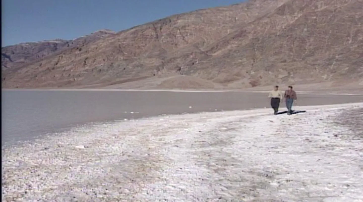
♪ (Jim) We're now entering the very lowest point of Death Valley at 282 feet below sea level, Badwater.
(Rudy) Isn't it amazing to be walking at the lowest elevation in The Western Hemisphere.
(Jim) One of the hottest and driest places in all of North America.
(Rudy) It's an interesting mix, and with all of the salt have been deposited here by the action of water we were looking at a minute, makes it extra special, and not often do you see maybe this much water here.
We've got water that's covering a good part of the salt pan.
It's not deep, but water, nonetheless.
Then the wonderful mountains and alluvial fans in the distance.
Still very active.
The bottom of this graben is tilted to the east.
That's why this is the lowest point.
That western side is moving away from us to the north and west.
(Jim) As we look, we see so much water, like a beautiful lake.
It's hard to believe so many prospectors and early miners and pioneers died in this valley.
(Rudy) Terrible place for people, but there are a lot of plants and animals that do well here.
This has been a great trip because we started above everything and got those long views.
From the top, we could see Badwater, where we're standing right now, and the salt pan and all the rest.
Then we got to see, as we came down a little, Titus Canyon and all those jumbled rocks.
It's an amazing rock story here, as we said at the beginning.
(Jim) Ages-old rock.
(Rudy) Oh, yeah.
Then we talked about alluvial fans and got to actually walk through one, an old one, that is now newly eroded, and the natural bridge and the rest.
(Jim) Saw the fanglomerate.
(Rudy) The fanglomerate, and the piles of sand, and talked about the way the wind was working here.
Salt Creek, with those rare, endangered species, those little pupfish.
(Jim) Which go back to ancient times.
(Rudy) Probably connected with that old Pleistocene lake.
Then the salt brine just a moment ago and now Badwater.
What an appropriate name for this place.
(Jim) It's a land of many extremes with high temperatures -- even with a ground temperature of 200 degrees.
But the startling, astounding surprises of high and low, wet and dry, cold and hot, serenely beautiful, and yet very dangerous, makes it a major attraction.
Death Valley National Park in southeastern California.
Thanks for visiting it with us and join us again on the next "Nature Scene."
♪ ♪ "Nature Scene is made possible in part by a grant from Santee Cooper, where protection and improvement of our environment are equal in importance to providing electric energy.
Additional funding is provided by the Corporation for Public Broadcasting, and by viewers like you, members of the ETV Endowment of South Carolina.


Support for PBS provided by:
NatureScene is a local public television program presented by SCETV
Support for this program is provided by The ETV Endowment of South Carolina.